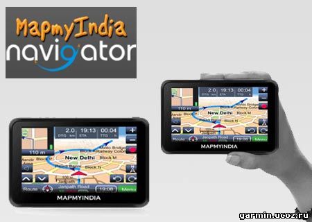
 MapmyIndiaΓÇÖs version 7.1 maps ΓÇô IndiaΓÇÖs most comprehensive, exhaustive, detailed and updated map coverage ΓÇô provide first- and best-in-class advanced navigation and driver assistance features with visual cues, such as: ΓÇóExtended lane guidance (telling the user which lane to get into prior to a turn or exit)
ΓÇóJunction views (how the upcoming intersection looks in real-life)
ΓÇóSign-posts (which major landmarks, localities and cities lie in the direction of upcoming turns)
ΓÇóDay-time based turn restrictions (based on time and day, whether the particular road is 2-way or one-way in a particular directions)
ΓÇóLive traffic (what is the live congestion on roads in the city)
MapmyIndia continues to offer the most localized navigation experience, with city guides and rich points of interest (which provide detailed descriptions and photographs of places to visit, stay, eat and shop in popular tourist destinations and cities) voice guidance in 9 regional languages and is also introducing regional maps in 4 local languages (which displays the map in the regional language), to aid users who prefer to communicate and interact with the navigation systems in local Indian languages and not just English.
MapmyIndiaΓÇÖs GPS navigation system enables accurate turn-by-turn voice-guided navigation to the building doorstep, not just a nearby landmark or the general locality. The version 7.1 MapmyIndia maps continue to provide best-in-class full 3D coverage of India, with digital elevation models and terrain across India, thousands of full-scale 3D landmarks across India, which offer life-like 360-degree views of popular tourist and commercial landmarks, and full 3D city models containing 3D buildings in residential and commercial areas for 36 major cities across India, including all the major metropolitan areas. >>>резервная ссылка<<<
| 

